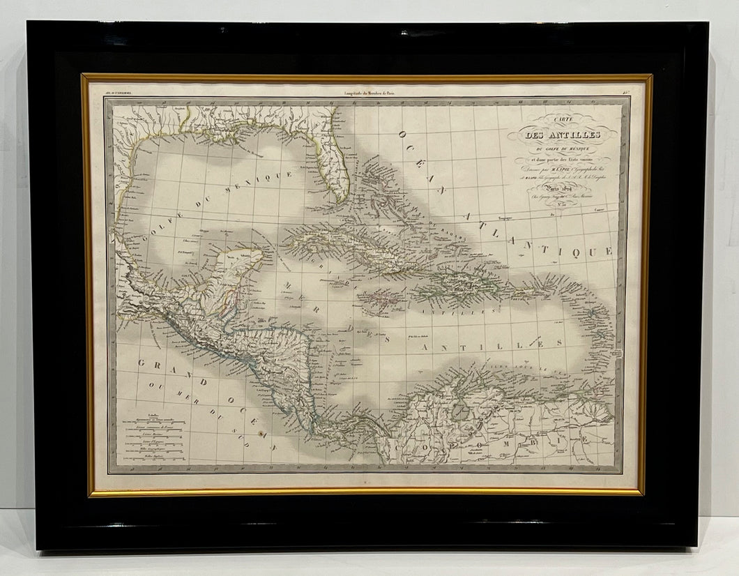
Beautiful hand-colored Atlas ' Universel de Geographie Ancienne et Moderne ' original map of Carte des Antilles, du golfe du Mexique et d'une partie des Etats voisins (The Antilles, the Gulf of Mexico and part of the neighbouring states).
The date of first publication of this map in the state shown is 1829 (this date is printed on the map), however the date of printing is likely to have been 1836 as this was the release date of this version of the Atlas.
Artist/Cartogropher/Engraver: Pierre Lapie, and Alexandre Emile Lapie (fils).
Almost 190 years old!
Measures approx. 27" x 21 1/4" framed.